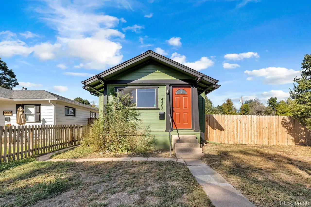
4403 South Logan Street, a home Byron listed in Englewood

City, town or suburb · Arapahoe County

Englewood

Englewood is an inner ring city immediately south of Denver along South Broadway and the South Platte River, with bungalows and postwar homes on a tight grid and apartments near light rail. Englewood Station on the C and D Lines anchors CityCenter, the Gothic Theatre is on Broadway, and Belleview Park has a children’s farm.

If you are buying: Englewood has its own city government and permit process. Buyers planning renovations should check Englewood rules, which differ from Denver’s.

Englewood is an incorporated city in Arapahoe County, about 7 miles south of downtown Denver in a straight line. Housing is a mix of 52% single family houses, 6% townhomes and other attached homes, 7% duplexes and small buildings and 35% in buildings of five or more units, and the typical home was built around 1970. Parks inside its boundary include Belleview Park, Centennial Park and Cornerstone Park. RTD rail serves the area at Englewood Station.

Byron’s notes

Food & drink
South Broadway restaurants and shops.
Getting around
Light rail at Englewood CityCenter and Oxford; Santa Fe Drive.
Landmarks
Medical district around Swedish Medical Center and Craig Hospital.

Living in Englewood

What people enjoy

  • Parks: Belleview Park, Centennial Park, Cornerstone Park, Hosanna Athletic Complex, Bates Logan Park and Jason Park, plus 9 more named parks.
  • Arts, museums and attractions: Belleview Children's Farm and Gothic Theatre.
  • Golf: Colorado Journey Mini Golf.
  • Pools and rinks: Pirates Cove.
  • Dining: OpenStreetMap lists about 71 restaurants, cafes and bars inside the area.

Everyday life

  • Groceries: Safeway and Walmart Supercenter inside the area.
  • Hospitals and emergency care: Swedish Medical Center (about 0.9 miles) and Craig Hospital (about 1.0 miles).
  • Libraries: Sheridan Library (about 2.0 miles) and Bemis Public Library (about 2.7 miles).
  • Recreation and community centers: Englewood Recreation Center and Sheridan Recreation Center (about 2.0 miles).

Distances are straight line from the center of the area, not driving distances.

Homes and housing in Englewood

Housing units
21,379
Single family detached
52%
Townhomes and attached
6%
Duplexes to fourplexes
7%
Buildings of 5 to 19 units
11%
Buildings of 20 or more units
24%
Mobile and manufactured homes
1%
Owner occupied
47% of occupied homes
Median year built
1970
Built before 1950
19%
Built 2010 or later
9%
Median owner home value
$522,466
Median contract rent
$1,522

Figures combine the 13 Census tracts centered inside this area; tract lines do not follow its boundary exactly. Housing type and age: ACS 2018 to 2022 5 year estimates. Home value and rent: ACS 2019 to 2023 5 year estimates. Census estimates have margins of error and lag the current market; home values are owner estimates, not sale prices.

Buying a home in Englewood

How Byron helps buyers

Selling a home in Englewood

  • For context, the Census estimate of the median owner home value here was $522,466 (ACS 2019 to 2023 5 year estimates). That figure lags today’s market; pricing should rest on recent comparable sales. Denver Metro Association of REALTORS market trends reports (opens in a new tab)
  • Have HOA documents, the current budget, reserve study and rules ready early; buyers and lenders review them closely.
  • If your home is within walking distance of places like Belleview Park, Centennial Park or Englewood Station, say so in your listing; buyers often value it.
  • Estimate what you would walk away with after costs. Seller net sheet

How Byron helps sellers

Schools serving Englewood

Englewood is split between Englewood Schools (about 77% of the area), Sheridan School District (about 13% of the area), Littleton Public Schools (about 6% of the area) and Cherry Creek School District (about 3% of the area). School assignment depends on the exact address, can change over time, and many districts offer choice enrollment. Confirm the assigned schools for a specific home directly with the district.

Schools near Englewood on GreatSchools (opens in a new tab)

Getting around Englewood

  • EPA National Walkability Index: 14.2 out of 20, which the EPA classes as above average walkability (population weighted across 29 Census block groups).
  • RTD rail stations: Englewood Station (C and D Lines).
  • RTD bus: 9 routes stop inside the area, including 0, 0B, 12, 22, 24, 30, 35 and 36.
  • Major routes: US 285 and US 85.
  • How workers here commute (ACS 2018 to 2022 5 year estimates): 66% drive alone, 7% carpool, 4% take transit, 3% walk or bike, and 17% work from home.

Places near Englewood

Sources and helpful links

Information last checked November 19, 2026. Details change; confirm anything important for a specific property with the source. Boundary: U.S. Census Bureau TIGERweb incorporated place (GEOID 0824785). Population and housing units: 2020 Census. Simplified for display.

Thinking about Englewood?

Whether you are curious about prices, comparing areas or planning a move, a short conversation is a good first step. No obligation, no pressure.